

This is a practical and unique explanation prepared by Andrew Millison as part of an Oregon State University’s Online Permaculture Design Certificate Course.
Keyline Design was developed by Australian farmer and engineer P.A.Yeomans (1905-1984) and his sons, it was the first integrated design system for agricultural ( and urban) development based on insights into fundamental, repeating land shapes and farm elements whose management is essential due to their relative permanence in the landscape.
The series is divided into 7 stages, the last being urban design.

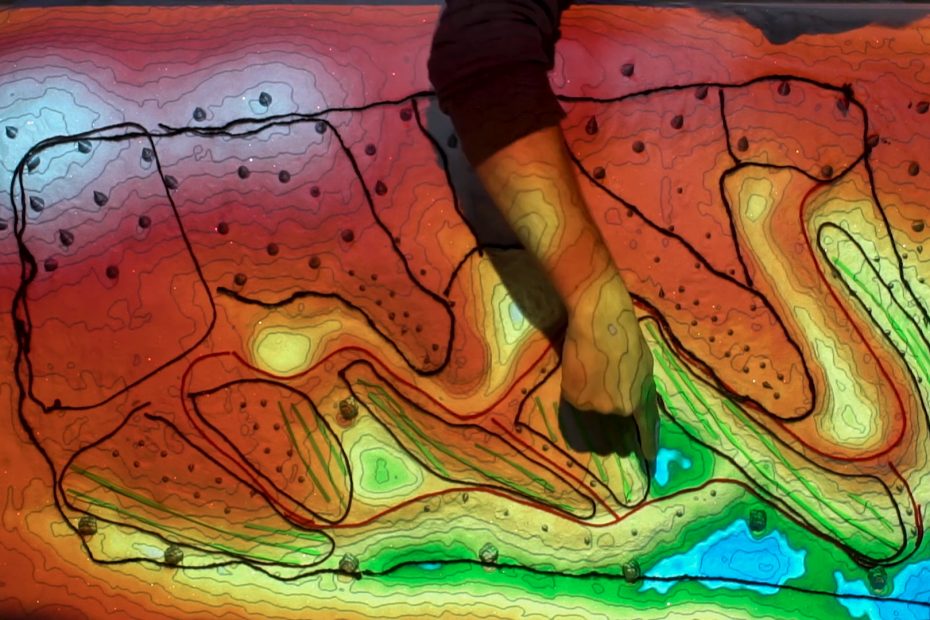
Contour lines and water flow
Understanding contour lines; identifying slope, ridges and water drainage lines.
Landform water divides
Reading the shape of the landscape; identifying main ridges, spines, arms and water catchment areas.
Design for water
Water retention zones, keypoints, keypoint ponds, dams, irrigation zones, keyline cultivation patterns and water reconstitution zones.
Design for access
Water and access is generally married. Road designs, dry and wet areas and runoff management.
Design for trees
Managing low atmospheric moisture. Riperian forests for retention and habitat. Contour strip forests. Planning for major storm events.
Design for management
Boundary lines. Management units created by ridges, riperian areas and roadways. Primary land units, managed through use of permanent fencing and temporal fencing.
The city forest
Concepts for water management in urban environments.
Hi, I wonder if it would be ok to use the main photo on this page: https://goodall-maps.com/2020/09/keyline-explained-in-a-unique-way/ along with your logo for Goodall Maps and the description “This is a practical and unique explanation prepared by Andrew Millison as part of an Oregon State University’s Online Permaculture Design Certificate Course” on a slide for a permaculture design lecture?
Many thanks,
Féidhlim Harty, Ireland